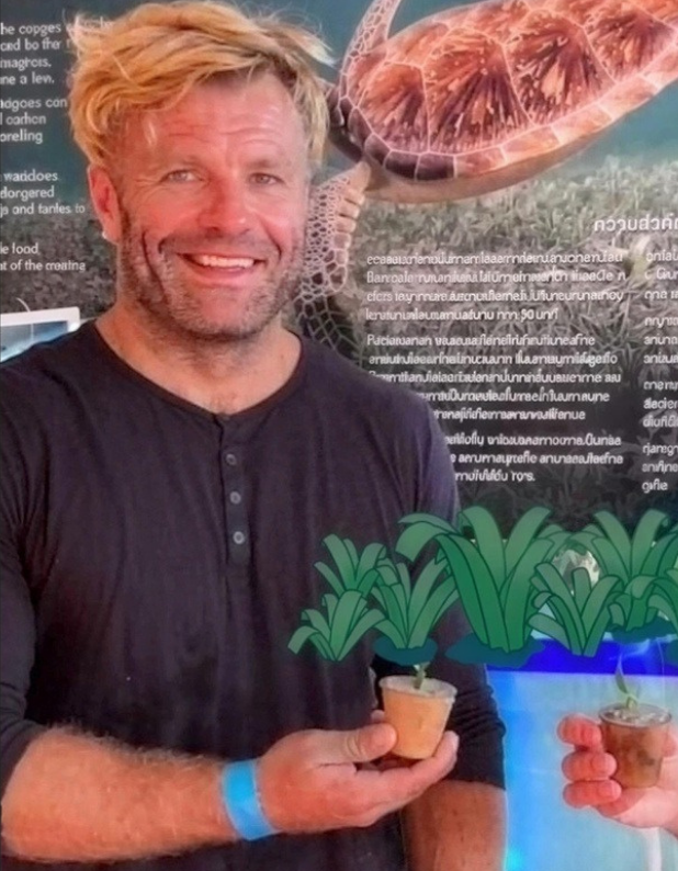
James Rood is Head Sea Gardener at Bahari Yetu (“Our Ocean”), a marine conservation, education and research organisation based in Zanzibar. After more than 15 years working offshore in subsea drilling, well control and marine operations, James is now applying engineering and systems thinking to marine conservation. Their profile explores how field surveys, sonar, photogrammetry, GIS and machine learning can be used to build practical and repeatable ways of measuring marine ecosystems.
Profile snapshot
Role: Head Sea Gardener at Bahari Yetu
Organisation type: Private company
Country / region: Tanzania (Zanzibar) / Africa
Role type: Engineer
Focus areas: Monitoring, Technology, Seagrass, Coral reefs, Mangroves, GIS and mapping
Jump to
Your current role
What is your current role and what kind of organisation do you work for?
I’m currently developing Bahari Yetu (“Our Ocean”), a marine conservation, education and research organisation based in Zanzibar.
My background is somewhat unusual for this sector. I’m a mechanical/hydraulic engineer and spent more than 15 years working offshore in subsea drilling, well control and marine operations. I’ve worked with subsea equipment, pressure-control systems, blowout preventers, control systems and the operational side of keeping complicated equipment working safely in a fairly hostile environment. I’m now applying that engineering experience to marine conservation.
What interests me is the gap between environmental ambition and environmental measurement. There are some fantastic projects happening, but the environmental sector can sometimes become very good at producing impressive-looking projects and terminology without necessarily having equally robust systems for measuring what is actually happening. I’m interested in making that measurement more practical.
At Bahari Yetu we're developing field capability around seagrass, coral reefs and mangroves, combining conventional ecological surveys with technologies such as sonar, underwater video, reef photogrammetry, GPS mapping, computer vision and machine learning. The objective isn't to use technology because it looks impressive. It is to ask: what problem are we trying to solve, and what is the simplest reliable way of measuring it?
What does a typical week look like?
There really isn't a typical week yet! A lot of my time is currently split between fieldwork, engineering, data and building the organisation.
On the field side, that might mean taking our small survey vessel out to collect sonar data, running fixed survey transects, deploying underwater video or working in the intertidal zone collecting seagrass measurements. We're developing repeatable surveys rather than simply going out and taking interesting photographs.
For seagrass, for example, we establish fixed transects and quadrats and record things such as species, percentage cover, shoot density, habitat condition and photographic evidence. Those locations can then be revisited and compared over time.
For reef work, I'm particularly interested in photogrammetry. By taking overlapping images systematically, we can reconstruct sections of reef as three-dimensional models rather than reducing the reef to a few photographs. That gives us the potential to measure changes in habitat structure over time.
We're also working with BRUV — baited remote underwater video — to look at fish assemblages without putting divers into the water. A fixed camera deployment gives us a standardised observation period that can be reviewed afterwards.
And then there's the sonar work. Coming from offshore, I'm very comfortable with acoustic systems and the idea of using a vessel as a survey platform. We're experimenting with how relatively accessible sonar equipment can be used to map and characterise shallow marine habitats.
The other half of the week is turning all of that into something useful: processing data, building workflows, looking at GIS, developing machine-learning approaches and working out how other organisations could actually use the information we collect, and building a container home for interns.
What skills do you use most often?
The biggest one is probably systems thinking. Offshore engineering teaches you to look at a problem as a system rather than as an individual piece of equipment. A sensor is only useful if it is calibrated, operated correctly, recorded properly and the resulting data is managed properly. I'm applying exactly the same thinking to environmental monitoring.
Technically, I'm using my mechanical and subsea engineering background alongside:
- Marine survey design
- Sonar and acoustic data collection
- Underwater video and BRUV
- Reef photogrammetry and 3D reconstruction
- GPS and spatial mapping
- Seagrass ecological surveying
- Data management and quality assurance
- GIS
- Image processing
- Computer vision
- Machine learning
We're particularly interested in machine learning as a tool for dealing with scale. If you have thousands of underwater images or hours of video, manually examining every frame becomes increasingly difficult. Computer vision can potentially help identify fish, seagrass or habitat features and make the human analyst much more efficient.
But I don't see ML as replacing field science. If the underlying data collection is rubbish, machine learning just gives you a very sophisticated way of producing rubbish faster.
That is probably the most important lesson I'm carrying across from engineering.
Your route into this work
How did you get into this work?
It wasn't a conventional route into marine conservation.
I originally trained as a Biology at Loughborough University and Marine Engineering at Warshash Maritime School at Southampton Solent Uni. Then I went into the offshore industry.
I spent more than 15 years working around subsea drilling and well-control systems, including pressure-control equipment, subsea control systems, blowout preventers and marine operations. It was a world where systems have to work. You can't rely on a PowerPoint presentation telling you that the system should work.
Eventually I became increasingly interested in applying that way of thinking to environmental problems. Living and working around the marine environment made the connection fairly obvious. I started looking at how we could use engineering approaches and relatively accessible technology to collect better environmental information. That developed into the work I'm now doing in Zanzibar.
The transition hasn't really been from engineering to conservation. It's more from engineering offshore systems to trying to understand marine ecosystems as systems.
And actually, the second problem is considerably harder.
What education, training or experience helped you get into this role?
The marine engineering degree gave me the technical foundation, but most of what I use now came from working offshore.
The offshore environment taught me about risk, procedures, equipment reliability, data, troubleshooting and operational discipline. Subsea engineering is particularly useful because you're dealing with systems that are difficult to see and difficult to access. You have to understand what your instruments are telling you and, equally importantly, what they aren't telling you.
That mindset is incredibly transferable to marine science. If I put a sonar transducer on a boat, for example, I don't automatically assume that the resulting image represents reality. I want to understand the equipment, the acquisition conditions, the limitations and how we can repeat the survey. The same applies to underwater video, photogrammetry and biological surveys.
I've also had to learn a lot independently — Python, data processing, computer vision, machine learning, GIS and marine survey techniques. I'm still learning. That's one of the things I enjoy about this field: there is no point where you know everything.
Is there anything people think they need for this career that may not actually be essential?
You don't necessarily need to be a marine biologist. Obviously specialist ecological knowledge is incredibly important, and I work with people who have that expertise.
But there is a huge amount of value in people coming into marine conservation from engineering, data science, software, mapping, electronics, photography, robotics and other technical disciplines.
The ocean is an enormous measurement problem.
We need people who can build things, operate boats, process data, manage datasets, develop sensors, analyse imagery and design reliable systems. And perhaps most importantly, we need people who are prepared to go into the field and actually do the work.
You don't need the world's most expensive equipment to start asking useful questions. Sometimes you need a boat, a camera, a quadrat, a GPS and a decent methodology.
Reflections and advice
What advice would you give someone interested in this kind of work?
Get practical as early as possible.
Don't spend two years learning about conservation before ever collecting a dataset. Find an organisation, university, NGO or project doing marine fieldwork and get involved. Learn how a survey is actually conducted. Learn how data is recorded. Learn why the methodology matters.
Then start adding technical skills. Learn some GIS. Learn basic Python. Learn how to process imagery. Understand GPS. Learn how to handle datasets properly.
And if you're interested in AI or machine learning, don't start with the AI. Start with the environmental question. Ask what you need to measure, what data you need, how you are going to collect it and how you are going to validate it. Then ask whether machine learning can help.
I'd also encourage people from engineering backgrounds not to assume that environmental careers are closed to them because they don't have an environmental degree.
The marine sector needs engineers.
What is one mistake, challenge or lesson from early in your career that taught you something useful?
One of the biggest lessons from offshore was learning not to confuse confidence with evidence. In engineering, you learn very quickly that something either works or it doesn't. If a valve doesn't operate, no amount of enthusiasm changes the fact that it doesn't operate.
Environmental systems are much more complicated. You can have a beautiful reef photograph, an impressive project, an expensive piece of technology or a very convincing presentation — and still not have a reliable measurement of ecological change.
That has made me quite interested in assurance. What exactly are we claiming? What evidence supports it? Can somebody else repeat the measurement? What are the limitations? And what happens when the data doesn't support the story we hoped for?
I think good environmental work should be comfortable with those questions.
Where do you see this field heading, and what opportunities does that create?
I think we're going to see a huge growth in marine observation and environmental data. Sensors are becoming cheaper. Cameras are everywhere. Drones, sonar, photogrammetry and autonomous systems are becoming increasingly accessible. At the same time, machine learning is becoming much better at processing large volumes of imagery and video.
The opportunity isn't simply to collect more data. It's to build better systems around the data. For example, instead of a reef survey producing a folder of photographs that nobody looks at again, you can potentially combine standardised photography, photogrammetry, biological observations, spatial information and automated image analysis into a repeatable monitoring system.
The same principle applies to seagrass. A quadrat survey gives you a snapshot. Repeat the same methodology at fixed locations and suddenly you're beginning to build a dataset that can tell you something about change.
I think the people who can bridge these disciplines — marine ecology, engineering, field operations, data science and machine learning — are going to become increasingly valuable.
And that is ultimately what I'm trying to build with Bahari Yetu: not technology for technology's sake, and not conservation for the sake of producing impressive stories — but practical systems that allow us to understand what is actually happening in the ocean.